

Stob Daimh [Stob Diamh]
Good walks are even better shared.
NN0930 : Looking West to Ben Cruachen from the Summit of Stob Diamh 998 m
Iain Lees Photo source
Overview
Stob Daimh [Stob Diamh]
Stob Daimh, towering at 1001 meters (3283 feet), is a gem hidden in the rugged expanse of the Scottish Highlands. This Munro beckons hikers with its majestic views and rich geological features.
Geology
Stob Daimh showcases a combination of schist and granite, sculpted over millennia by glacial forces. The exposed rock faces tell tales of ancient geological processes, while the softer grassy slopes provide a contrast that keeps your feet happy, if your legs disagree.
Routes
Hikers can embark on several routes, with the Golden Eagle Route and Coire Buidhe Route being the most popular. Whether you're a seasoned mountaineer or a casual wanderer, there's a path that fits your experience level. Just remember, if a path looks too easy, it may also lead you to an unexpected adventure!
Summit Features
At the summit, you'll find a prominent cairn and a trig point, both ideal for a celebratory snap. Trust us, your friends won't believe that you trekked up to 1001 meters without a sherpa!
Terrain
The terrain varies from rocky outcrops to grassy plateaus, with a few boggy patches that might challenge your cartoonish balance skills. Tread carefully and embrace the wildness—it's part of the fun!
Views
On a sunny day, expect panoramic vistas of Loch Awe and the peaks surrounding you. The view from Stob Daimh exemplifies the rugged beauty of the Highlands, making the effort worthwhile. The best time to appreciate these sights? Late spring through early autumn, preferably during sunrise or sunset for that Insta-worthy glow.
Hazards
As with any mountain, caution is advised. Steep inclines and loose rocks are common, so a good pair of hiking boots and a steady pace go a long way. And let’s not forget the unpredictable Scottish weather; it's always best to be prepared!
Access
Getting to Stob Daimh is straightforward. The nearest parking is along the A85 close to the start of the hikes. For public transport, services from Oban bring you to Dalavich, though you may need to factor in waiting times for buses.
Nearby Summits
If you're feeling energetic, why not bag a few more Munros nearby? Ben Cruachan and Ben Starav are just a hop, skip, and a jump away.
Facilities
Amenities in Kilmartin and Oban offer facilities such as cafes and toilets, ensuring you have what you need before and after your climb.
History
The name 'Stob Daimh' translates to 'the peak of the stag', a nod to the rich wildlife and folklore surrounding these lands. Its cultural significance in the local community means you'll tread on paths filled with history and stories.
So, lace up those hiking boots, pack your best sense of adventure, and come explore Stob Daimh—the mountain that promises both challenge and beauty in abundance.
Explore routes near Stob Daimh [Stob Diamh]
Walks starting near this hill. Open a route to check its map, distance and full itinerary.
Beinn Ime from Succoth
View route
The Cobbler from Succoth Carpark
View route
Ben Lomond in the trossachs
View route
Ben Nevis via Mountain Path
View route
Route planning notes
These notes describe possible approaches. Check a route's map and access information when planning your walk.
Golden Eagle Route
A popular yet challenging ascent starting from the A85 near the village of Kilmartin, leading climbers through varied terrain with stunning views of the surrounding hills.
Coire Buidhe Route
A slightly more straightforward path that traverses through glens, offering beautiful views and a more gradual ascent for those looking to enjoy the journey.
Make a day of it, together
Find someone to share the walk with, or organise a day out along a route you like.
Photo Gallery
View all Photo could not load
NN0930 : Looking West to Ben Cruachen from the Summit of Stob Diamh 998 m
Iain Lees
 Photo could not load
NN0930 : Looking west from the summit of Stob Diamh
Steven Brown
 Photo could not load
NN0930 : Stob Daimh
Alan Reid
 Photo could not load
NN0930 : The final pull to the summit of Stob Diamh
Iain Lees
 Photo could not load
NN0930 : On Stob Daimh
Adam Ward
 Photo could not load
NN0930 : Stob Diamh : Munro No 143
Graham Ellis
 Photo could not load
NN0930 : Stob Diamh summit
Stephen Sweeney
 Photo could not load
NN0930 : Stob Diamh from Drochaid Ghlas
Colin Park
 Photo could not load
NN0930 : Looking to Stob Diamh from the Summit of Stob Garbh 980m
Iain Lees
 Photo could not load
NN0930 : Stob Diamh summit
Scott Cormie
Hill facts and local notes
Classifications
Elevation
999m
3,278 ft
Prominence
134m
Coordinates
56.4313, -5.0913
NN094308
OS Map
50
Explorer: 377W
At the Summit
The summit is marked by a distinctive cairn and a trig point, both of which provide perfect photo opportunities for the social media savvy.
Terrain & Geology
The mountain is primarily composed of schist and granite, which gives it a rugged appearance. This combination creates a fascinating tapestry of mineral formations, ideal for geology enthusiasts.
Views & Scenery
From the summit, you can see the magnificent Loch Awe, the rugged peaks of the surrounding hills, and even the distant outline of Ben Cruachan. Bring your binoculars—you might spot some wildlife!
History & Heritage
Name Origin
In Scots Gaelic, 'Stob Daimh' translates to 'the peak of the stag', which pays homage to the wildlife that once roamed these highlands.
Historical Significance
Stob Daimh is a significant landmark for local climbers and walkers, featuring in many hillwalking routes and guides, symbolizing the spirit of adventure.
Getting There & Facilities
Parking
There is parking available at the start of the Golden Eagle Route along the A85, which accommodates several vehicles. Arrive early to avoid disappointment!
Public Transport
Buses run to the nearby village of Dalavich from Oban; however, check schedules as they can be infrequent.
Nearby Facilities
There are public toilets available in nearby Kilmartin, as well as a few cafes in Oban providing refreshments post-hike.
Safety Information
Known Hazards
- Steep and uneven ground can be tricky, especially in wet conditions. Visibility can also drop rapidly, so it’s worth keeping an eye on the weather.
General Safety Tips
- Check weather conditions before setting out
- Carry appropriate clothing and equipment
- Let someone know your planned route
- Take a map, compass, and GPS device
- Carry emergency supplies: food, water, first aid kit, torch
Hills
Some common questions about the hills answered
Are there group walks up Stob Daimh [Stob Diamh]?
Many walkers use Walkmates to join or organise walks with others. You can check for group walks around Stob Daimh [Stob Diamh] through the maps
Are there other walkers around Stob Daimh [Stob Diamh]?
Activity varies by location and time, but Walkmates lets you see whether others have shared walks or shown interest in this area. Find other people through the walking friends search walking friends for Stob Daimh [Stob Diamh] search or of course create your own walk for Stob Daimh [Stob Diamh]
Can I organise a walk to Stob Daimh [Stob Diamh]?
Yes. If there aren’t any walks listed already, you can create a walk and make it available for others to join.
If you're signed up to Walkmates, you can create a walk to Stob Daimh [Stob Diamh].
How do I find a walk up this hill?
There are often multiple ways to walk this hill, depending on experience and route preference. Walkmates helps you explore walks and routes that others have shared.
Can I suggest a new route up Stob Daimh [Stob Diamh]?
Yes. You can suggest or create routes to share with others. Walkmates focuses on the social side of walking, so routes are used to help people organise walks and explore areas together, rather than as detailed navigation tools or route libraries.
Other uses really appreciate knowledgeable walkers sharing their routes. Share your favourite route to Stob Daimh [Stob Diamh] here
The is an error or something incorrect about this hill. How do I let you know?
We always strive to keep the information on Walkmates as accurate as possible. If you find an error, please let us know through the contact form and we'll aim to correct it as quickly as possible
Community Discussion
Comments
Location
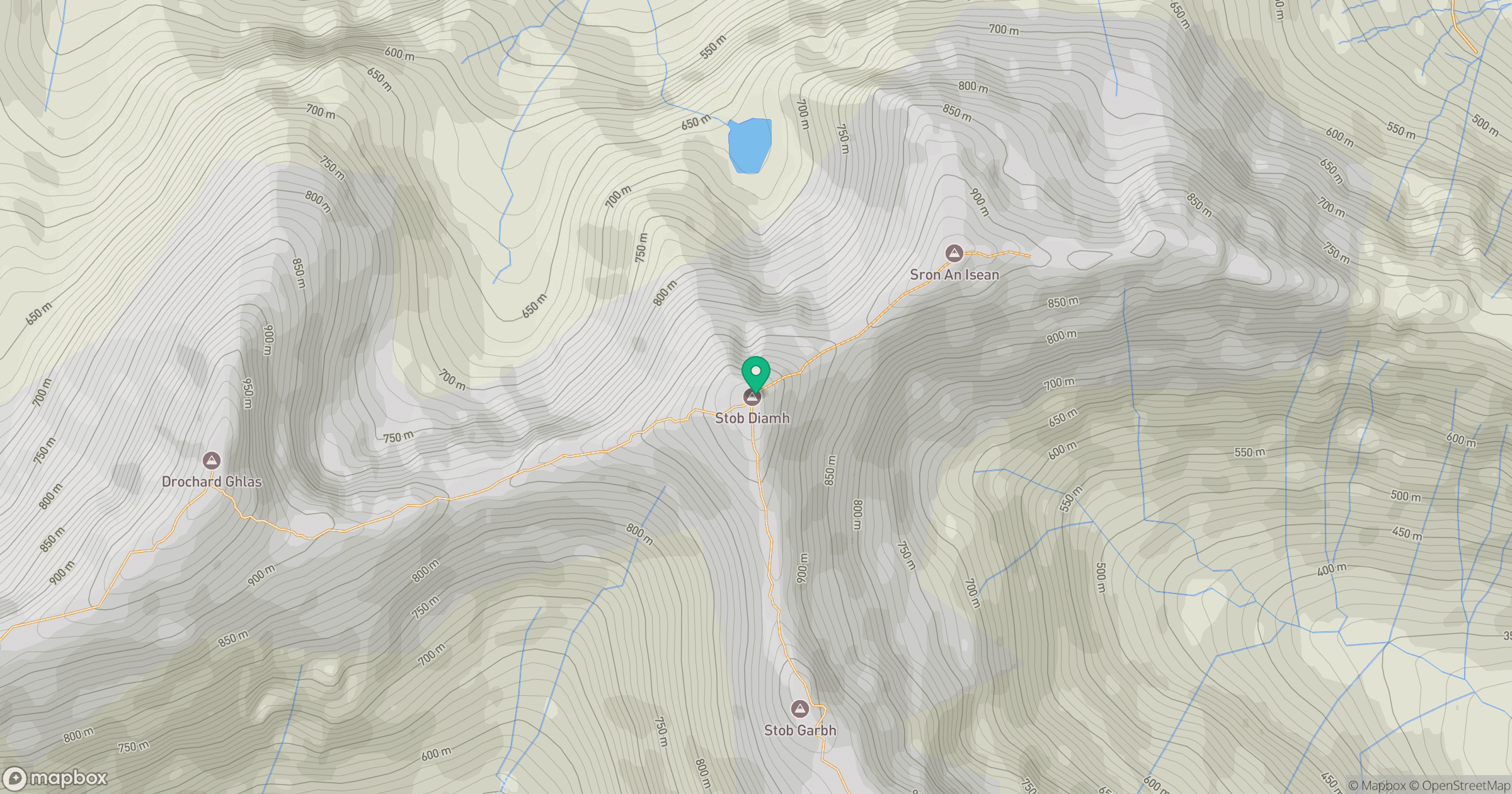
Grid reference: NN094308
View on OpenStreetMapOpens a map in a new tab, centred on the hill.
No comments yet. Be the first.